
Topic overview
Briefly
- FAA issued a ground stop for Denver International Airport due to thunderstorms encroaching on final-
- Arrivals from the contiguous U.S. faced an average delay of 114 minutes, with ground delay expected
- National Weather Service issued a severe thunderstorm watch for the Front Range until 9 p.m., with
What happened
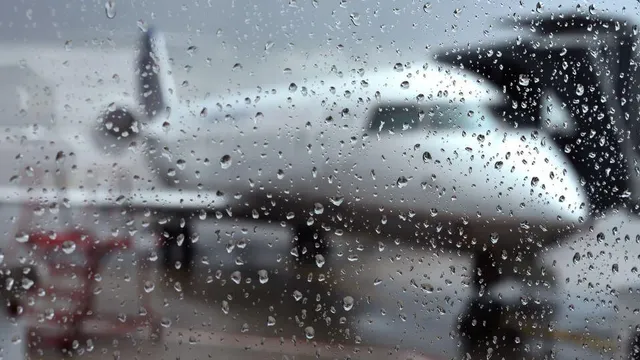
On Saturday, August 15, 2026, the Federal Aviation Administration (FAA) issued a ground stop for Denver International Airport (DIA) as severe thunderstorms moved into the Denver metro area. The ground stop, effective until 4 p.m., was implemented because thunderstorms were encroaching on final approach courses, forcing officials to hold arrivals. The FAA indicated a more than 60% chance that the ground stop would be extended beyond the initial timeframe. Departures from the contiguous United States to Denver were experiencing an average delay of 114 minutes, with the ground delay expected to last until 9:59 p.m. The National Weather Service had issued a severe thunderstorm watch for the Front Range until 9 p.m., and CBS Colorado Meteorologist Callie Zanandrie warned that rainfall rates in the Denver metro area could approach 1-2 inches in 30 minutes, leading to localized flash flooding. The primary concerns with these storms were damaging winds and large hail. Another round of heavy rain was expected to impact the Front Range throughout the weekend, exacerbating the potential for flooding and travel disruptions. The ground stop and delays were a direct response to the hazardous weather conditions, affecting both arriving and departing flights. Passengers were advised to check with their airlines for specific flight status updates. The FAA's decision to hold arrivals was a precautionary measure to ensure safety as the storms passed through the region. The severe weather was part of a broader pattern affecting the Front Range, with the potential for additional storms and heavy rainfall in the coming days. The situation remained fluid, with officials monitoring the weather closely and adjusting operations as necessary. The ground stop was a significant disruption for travelers, with many facing extended delays. The FAA's ground delay program was designed to manage air traffic flow during adverse conditions, and the 114-minute average delay reflected the severity of the weather. The thunderstorms were expected to continue into the evening, with the potential for more severe weather overnight. The combination of heavy rain, hail, and damaging winds posed a serious threat to the region, and authorities urged residents and travelers to stay informed and take precautions. The ground stop was lifted or extended based on real-time weather conditions, and the FAA coordinated with airlines to minimize disruptions. The impact of the storms was not limited to the airport, as the heavy rainfall could lead to flash flooding in low-lying areas. The National Weather Service's severe thunderstorm watch remained in effect, and residents were advised to monitor local alerts. The situation highlighted the challenges of managing air travel during severe weather events, and the importance of timely communication between authorities and the public. As the storms moved through, the FAA and airport officials worked to restore normal operations as quickly as possible, but the potential for further delays remained. The weekend forecast called for more rain, which could prolong the disruptions. Travelers were encouraged to plan ahead and allow extra time for their journeys. The ground stop was a necessary measure to ensure the safety of passengers and crew, and the FAA's actions were in line with standard procedures during severe weather. The thunderstorms were part of a larger weather system affecting the region, and the Front Range was expected to experience continued unsettled weather. The impact on the airport was significant, with many flights delayed or canceled. The FAA's ground delay program was a key tool in managing air traffic during such events, and the 114-minute average delay was a clear indication of the storm's severity. The situation was developing, and further updates were expected as the weather evolved. The ground stop was a temporary measure, and the airport was expected to resume normal operations once the storms passed. However, the potential for additional storms meant that travelers should remain vigilant and check for updates. The severe weather was a reminder of the importance of preparedness and the need for effective communication during emergencies. The FAA's decision to hold arrivals was based on safety considerations, and the agency worked closely with airlines to minimize the impact on passengers. The thunderstorms were expected to bring heavy rain, hail, and strong winds, and the potential for flash flooding was a major concern. The National Weather Service's watch was a precautionary measure, and residents were advised to stay indoors and avoid unnecessary travel. The ground stop was a significant disruption, but it was a necessary step to ensure the safety of all involved. As the storms continued, the situation remained fluid, and authorities were prepared to take further action if needed. The weekend forecast called for more rain, and the Front Range was expected to experience continued unsettled weather. The impact on the airport was significant, with many flights delayed or canceled. The FAA's ground delay program was a key tool in managing air traffic during such events, and the 114-minute average delay was a clear indication of the storm's severity. The situation was developing, and further updates were expected as the weather evolved. The ground stop was a temporary measure, and the airport was expected to resume normal operations once the storms passed. However, the potential for additional storms meant that travelers should remain vigilant and check for updates. The severe weather was a reminder of the importance of preparedness and the need for effective communication during emergencies. The FAA's decision to hold arrivals was based on safety considerations, and the agency worked closely with airlines to minimize the impact on passengers. The thunderstorms were expected to bring heavy rain, hail, and strong winds, and the potential for flash flooding was a major concern. The National Weather Service's watch was a precautionary measure, and residents were advised to stay indoors and avoid unnecessary travel. The ground stop was a significant disruption, but it was a necessary step to ensure the safety of all involved. As the storms continued, the situation remained fluid, and authorities were prepared to take further action if needed.

Comprehensive report
Full story,
in detail.
Trace the developments that led here, see how the story evolved, and understand the forces and wider context surrounding it.