
Topic overview
Briefly
- A weather front is approaching the Philadelphia region, bringing the threat of scattered thunderstorms.
- Some storms may become strong to severe, depending on the timing of the front's arrival.
- After Tuesday, the weather is expected to improve with lower humidity and more comfortable temperatures.
What happened
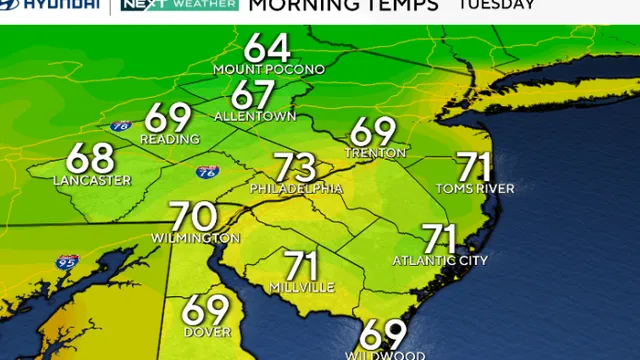
On August 11, 2026, the Philadelphia region is facing the threat of storms as a weather front approaches. Meteorologists have indicated that scattered thunderstorms are likely, with some of these storms potentially becoming strong to severe. The timing of the front's arrival is crucial, as it could significantly influence the intensity of the storms. Residents are advised to stay alert for changing weather conditions throughout the day. Following Tuesday's storms, the weather is expected to improve, with a decrease in humidity and temperatures trending closer to the 80s later in the week. This shift will provide some relief from the oppressive heat that has characterized the region recently.
The forecast for the week ahead shows a variety of weather conditions. On Wednesday, a morning shower is anticipated, leading to cooler temperatures with a high of 88 degrees Fahrenheit. Thursday is expected to be partly sunny, with temperatures rising again to around 90 degrees. By Friday, there may be a stray shower, but the weekend looks to be more stable with sun and clouds, and highs around 86 degrees. However, Sunday could bring late showers, and the following Monday may see a few thunderstorms returning. Overall, the weather pattern indicates a transition from the current heat wave to more moderate temperatures and less humidity, which many residents will likely welcome.
The potential for severe weather on Tuesday serves as a reminder of the unpredictable nature of summer storms in the region. As the front moves through, it is essential for residents to remain informed and prepared for any sudden changes in weather. The National Weather Service and local meteorologists will continue to monitor the situation closely, providing updates as necessary. This week’s forecast highlights the importance of staying aware of weather conditions, especially during the summer months when storms can develop rapidly and unexpectedly.

Comprehensive report
Full story,
in detail.
Trace the developments that led here, see how the story evolved, and understand the forces and wider context surrounding it.