
Topic overview
Briefly
- The Met Office has issued a thunderstorm warning for Northern Ireland from 11:00 BST until 06:00 on August 14.
- A potential heatwave could be confirmed if temperatures reach 25°C in parts of Northern Ireland.
- Residents are advised to stay informed and take precautions due to the severe weather conditions.
What happened
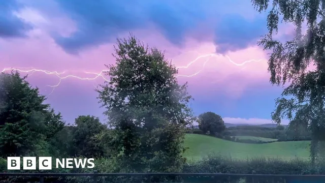
On August 13, 2026, Northern Ireland is experiencing a significant shift in weather patterns as the Met Office has issued a thunderstorm warning. This warning is in effect from 11:00 BST until 06:00 on August 14, indicating the potential for severe weather conditions. The thunderstorms are expected to bring heavy rainfall, with forecasts suggesting that some areas could see between 10-30 mm of rain in less than an hour. While many regions may avoid these downpours, the risk remains high for those that do experience the storms.
In addition to the thunderstorm warning, Northern Ireland is on the verge of confirming its fourth heatwave of the summer. A temperature of 25°C or higher, which is necessary to meet the criteria for a heatwave, is anticipated in certain areas, including Armagh. This would mark the most heatwaves recorded in Northern Ireland since the Met Office began tracking them in 2019. Heatwaves are defined as periods where temperatures exceed 25°C for three consecutive days, and the current weather conditions are affecting the entire island, with even higher temperatures expected in the Republic of Ireland.
The Republic of Ireland's Met Éireann has also issued a yellow level heat alert for regions including Leinster and Tipperary, which is valid until 06:00 local time on August 14. This alert highlights the widespread impact of the heat across the island, as both Northern Ireland and the Republic of Ireland grapple with extreme weather conditions. The combination of heat and thunderstorms presents a complex weather scenario that could lead to further complications, particularly for those in areas prone to flooding.
As the day progresses, the thunderstorms are expected to develop and may continue into the evening and overnight hours. The Met Office has cautioned that where storms do occur, they could lead to significant rainfall and potential disruptions. The situation remains dynamic, and residents are advised to stay informed about weather updates and take necessary precautions to ensure their safety during this tumultuous weather period.

Comprehensive report
Full story,
in detail.
Trace the developments that led here, see how the story evolved, and understand the forces and wider context surrounding it.