
Topic overview
In brief
- Scattered showers and storms are expected in North Texas this afternoon due to a disturbance.
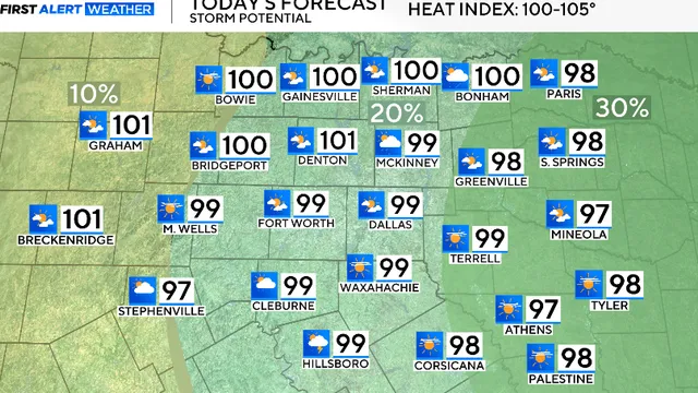
- Temperatures will reach near-triple-digit levels today, with heat index values between 100 and 105°F.
- Residents are advised to stay hydrated and take precautions against the heat as school resumes.
Summary
On Saturday, August 8, 2026, North Texas experienced a weather pattern characterized by scattered showers and storms, particularly in the afternoon. This weather activity was attributed to a disturbance that led to increased daytime heating, creating conditions conducive for storm development. While no severe weather was anticipated, there was a possibility of stronger storms producing gusty winds, small hail, and frequent lightning. As the day progressed, temperatures were expected to soar to near-triple-digit levels, with heat index values ranging from 100 to 105 degrees Fahrenheit. Winds were forecasted to be light, coming from the southwest at 5 to 10 mph.
As evening approached, cloud cover was predicted to gradually decrease, leading to a reduction in rain chances. The following morning, Sunday, August 9, 2026, temperatures were expected to start in the low 80s, with highs again reaching around 100 degrees. The forecast indicated a sunny day ahead, with similar wind patterns continuing. This weather pattern is particularly significant as it coincides with the back-to-school season, prompting parents to ensure their children stay hydrated during outdoor activities. The persistent heat and sunshine are expected to continue into the following week, with temperatures remaining near triple digits and heat index values potentially climbing between 105 and 110 degrees Fahrenheit.