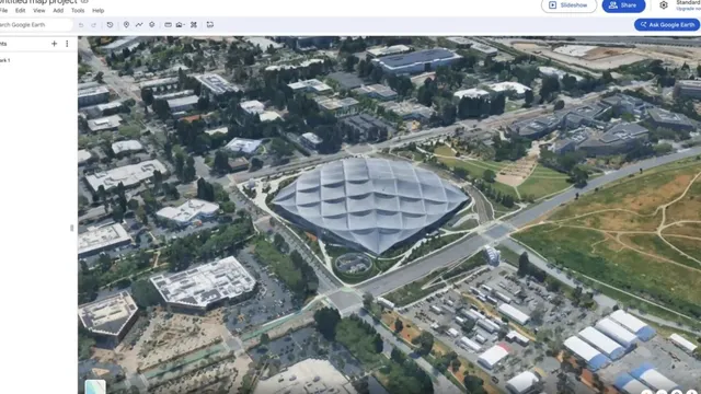
In a significant technological advancement, Google has integrated its Nano Banana 2 image generation model into Google Earth, enhancing the capabilities of the web application. This integration allows users to create AI-generated images by utilizing satellite, aerial, and 3D imagery available within the platform. The introduction of this feature marks a notable shift in how users can interact with geographical data, enabling them to visualize and manipulate locations in innovative ways. Users can now give buildings makeovers, visualize projects, or create infographics based on the imagery they are viewing.
The decision to incorporate AI image generation into Google Earth reflects a broader trend in the tech industry, where artificial intelligence is increasingly being used to enhance user experience and provide more interactive tools. By leveraging AI, Google aims to make geographical data more accessible and engaging for users, allowing them to explore and reimagine locations in ways that were previously not possible. This move is expected to attract a wider audience, including professionals in architecture, urban planning, and education, who can benefit from the enhanced visualization capabilities.
Furthermore, the use of AI in Google Earth could lead to new applications and innovations in various fields. For instance, architects and urban planners can use the tool to visualize potential changes to cityscapes, while educators can create interactive learning materials that incorporate real-world imagery. The implications of this technology extend beyond mere visualization; it opens up possibilities for data analysis and decision-making based on AI-generated insights.
As Google continues to develop and refine its AI capabilities, the integration of such technologies into widely used platforms like Google Earth signifies a commitment to innovation and user engagement. This development not only enhances the functionality of Google Earth but also sets a precedent for how AI can be utilized in other applications, potentially transforming the way we interact with digital maps and geographical information.