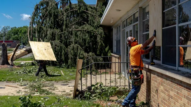
On July 21, 2026, parts of Long Island, New York, are bracing for severe weather as the National Weather Service predicts multiple rounds of heavy downpours and thunderstorms. The forecast indicates that showers could begin as early as late morning, with the likelihood of thunderstorms increasing throughout the day. The most severe storms are expected to hit Tuesday evening, raising concerns about flash flooding and dangerous winds. The weather service has issued a hazardous weather outlook for the northern part of Long Island due to these potential threats.
Meteorologist Brian Ciemnecki has warned that while the total rainfall could reach up to three-quarters to an inch, localized thunderstorms may produce even higher amounts. Wind gusts during these storms could reach as high as 60 mph, which poses a risk for localized tornadoes. The National Oceanic and Atmospheric Administration (NOAA) has categorized the severe thunderstorm risk for Western Suffolk and the East End as Level 1, while New York City and Nassau County face a Level 2 slight risk. Ciemnecki reassured residents that they should not panic about seeking tornado shelters on Long Island, as the strongest chances for tornadoes are expected in New Jersey, which is under a Level 3 enhanced risk.
As the storm system approaches, the weather service has also cautioned about dangerous rip currents at all ocean beaches, advising beachgoers to swim only when lifeguards are present. The forecast for Tuesday indicates highs in the upper 70s, with conditions expected to clear up by Wednesday morning, leading to warmer temperatures in the mid-80s. However, scattered showers may linger into Wednesday, but overall, the day is expected to be drier than wet.
In contrast to the severe weather in Long Island, Tropical Storm Bertha is developing in the Gulf of Mexico, moving toward the Florida Panhandle and Alabama. This storm has prompted tropical storm warnings and storm surge watches in the affected areas. As of Tuesday morning, Bertha was located about 110 miles south of Panama City, Florida, with maximum sustained winds of 50 mph. The National Hurricane Center has issued warnings for areas from the Florida and Alabama border to Louisiana, indicating that conditions are expected to worsen within the next 36 hours.